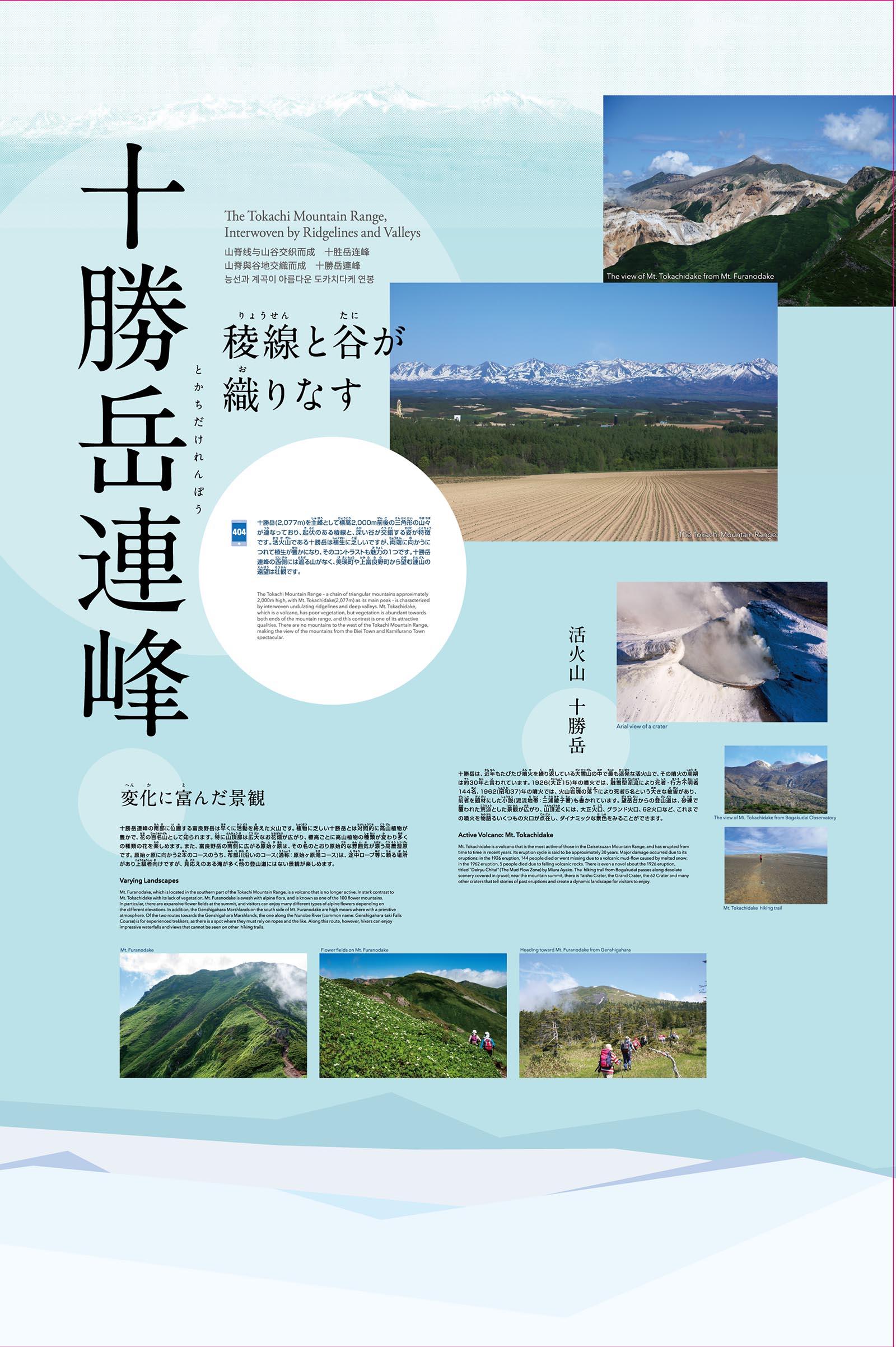


The Tokachi Mountain Range – a chain of triangular mountains approximately 2,000 m high, with Mt. Tokachidake (2,077m) as its main peak – is characterized by interwoven undulating ridgelines and deep valleys. Mt. Tokachidake, which is a volcano, has poor vegetation, but vegetation is abundant towards both ends of the mountain range, and this contrast is one of its attractive qualities. There are no mountains to the west of the Tokachi Mountain Range, making the view of the mountains from the Biei Town and Kamifurano Town spectacular.
Mt. Furanodake, which is located in the southern part of the Tokachi Mountain Range, is a volcano that is no longer active. In stark contrast to Mt. Tokachidake with its lack of vegetation, Mt. Furanodake is awash with alpine flora, and is known as one of the 100 flower mountains. In particular, there are expansive flower fields at the summit, and visitors can enjoy many different types of alpine flowers depending on the different elevations. In addition, the Genshigahara Plains on the south side of Mt. Furanodake are high moors where with a primitive atmosphere. Of the two routes towards the Genshigahara Plains, the one along the Nunobe River (common name: Genshigahara-taki Falls Course) is for experienced trekkers, as there is a spot where they must rely on ropes and the like. Along this route, however, hikers can enjoy impressive waterfalls and views that cannot be seen on other hiking trails.
Mt. Tokachidake is a volcano that is the most active of those in the Daisetsuzan Mountain Range, and has erupted from time to time in recent years. Its eruption cycle is said to be approximately 30 years. Major damage occurred due to its eruptions: in the 1926 eruption, 144 people died or went missing due to a volcanic mud-flow caused by melted snow; in the 1962 eruption, 5 people died due to falling volcanic rocks. There is even a novel about the 1926 eruption, titled ""Deiryu Chitai"" (The Mud Flow Zone) by Miura Ayako. The hiking trail from Bogakudai passes along desolate scenery covered in gravel; near the mountain summit, there is Taisho Crater, the Grand Crater, the 62 Crater and many other craters that tell stories of past eruptions and create a dynamic landscape for visitors to enjoy.

